Trail number
Not applicable
Trail length
14 kilometres return from trailhead (more from highway)
Elevation variance
200 metres
Trail type
Single trail, fire trail, gravel road
Trail surface
Smooth dirt, fine gravel, coarse gravel, rocks and rock outcrops
Weather affected
All weather
Trail condition sources
Nil
Trail features
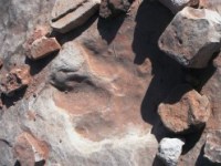
Lots of slickrock, ride amongst dinosaur footprints, hike into Arches National Park at end.
Trail obstacles
Constant climb, some sandy sections on lower roads


Trail rating
Easy, Intermediate
Rating basis
IMBA
Night riding
Could do - would have to watch out for crevices in slickrock - they can come up quickly.
Family Friendly
Younger MTBers with good skills and a bit of energy could give it a go. The young would lover the dinosaur footprints.

Click Image For Trail Map
No GPX download
The Klondike Bluffs Trail represents a solid ride. We stuffed up by starting at the highway car park as the Falcon guide indicated it started there and we got a bit lost also but we finally located the trail head at the big car park and we started climbing. I'd start at the main trailhead rather than the highway as it's just a gravel road up to the trailhead.
The route follows a 4WD trail across the slickrock which is imprinted with fossilized dinosaur tracks.
   |
|---|
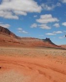
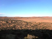
Cowboy country... Everywhere there's a view... |
 |
 |
 |
|---|---|---|
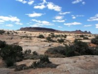
Slickrock heading up to Klondike Bluff |
||
 |
 |
 |
|---|---|---|
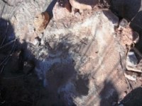
Dinosaur foot prints - nifty! |
||
 |
 |
 |
|---|---|---|
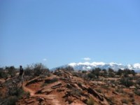
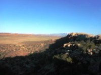
Views from bluff area |
||
Video of Klondike Bluffs area from Ron Deibert's channel.
 |
Parking is available at highway and the main trailhead (look for large car park on way in) |
|---|---|
 |
No toilet facilities are available. |
 |
No drinking water is available. |
 |
No food or drinks are available in the immediate area. |
 |
No local information facilities are available. |